| Card n. | Description | Locality | Linked sites |
| 3 | Acquatona ravine | Sappada | 51 - 100 |
| file .pdf | Nature Sites (SIN) | Google maps |
 |
 |
 |
- Description
- How to get there
- Interesting facts
- Bibliography
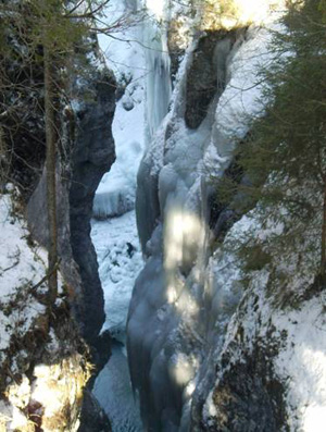
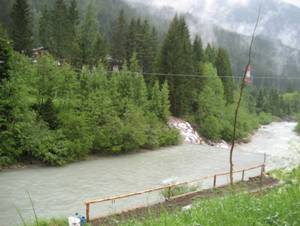
The Acquatona Ravine, or Katinaloch (literally, the gorge of Caterina) in the local Sappada dialect, is a deep gorge, some six metres wide, carved out in the rock by the waters of the Piave, which at this point encounters an affluent, dashing down for around 50 metres with a characteristic roar. The quality of the waters is good, and the watercourse here takes the form of a torrent. Inside the ravine we find cave vegetation: plants that thrive in a damp environment and are able to survive with minimum sunlight. Conifer forests are the predominant feature in the area around the ravine. Just a little further down from here there used to be the first port on the Piave, where the timber from the woods of Sappada was floated down towards the Cadore and thence to Venice. Until 1953, on the road next to the gorge, near the border between the Comelico area as such and Sappada, there was a large engraved boulder – which has now fallen into the water – the words on which recall the opening of the road in 1762: “VIA HANC AD UTINA TIROLIS USQUE CONFINIA / PASSUM MILIA LXX / CURRIBUS ANTEHAC INACCESSIBILITYM / ALLOYSIUS MOCENIGO P.F.I. PRAESES / MODICIS SIMPTIBUS BREVIORI TEMPORE / STRAVIT DECORAVITQUE AGGERIBUS MUNIVIT / PONTIBUS XXX QUA LAPIDEIS QUA SUBLICTIS / JUNXIT / ANNO SALUTIS MDCCLXII“ “Luigi Mocenigo, Lieutenant of Friuli, opened, at modest expense and in a brief period of time, this road, once inaccessible to carriages, 70,000 steps long, stretching from Udine to the edges of the Tyrol; he armed it, reinforced it and bound it together with 30 bridges, partly in stone and partly in wood. Year 1762”.
From Santo Stefano di Cadore, follow the SS35 trunk road; just before the neighbourhood of Lerpa, in Sappada, you can admire the spectacular rushing water from the covered bridge, or along the equipped route that leads down to the bottom of the precipice.
ACCESSIBLE: yes
MUNICIPALITY: Sappada
PLACE: Acquatona
GEOGRAPHICAL COORDINATES: X 1780015 – Y 5163980
PROVINCE: Belluno
FILE COMPILED BY: Nicoletti/Abordi/Lonzi
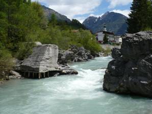
Santo Stefano di Cadore, just a little further down, once boasted a wealth of industrial buildings on the banks of the Piave and its affluent, the Padola torrent. These included the Feltrinelli sawmill (which once stood where the local primary school is now located), and the De Zolt sawmill (51 NS) on the left side of the Piave, which once had a private bridge linking it with Cunettone, of which no trace now remains other than documentary references.
Various Authors, Nuova guida di Sappada / Plodn, Pieve di Cadore (Belluno), Tipografia Tiziano 2010
ARPAV Belluno, Relazione annuale sulla qualità delle acque
