| Card n. | Description | Locality | Linked sites |
| 10 | Washtubs and fountains | Auronzo di Cadore - Cella, Rizio, De Filippo, Pais | 151 - 71 |
| file .pdf | Historical and Artistic Architectures (ASA) | Google maps | 137 - 138 |
 |
 |
 |
- Description
- How to get there
- Interesting facts
- Bibliography
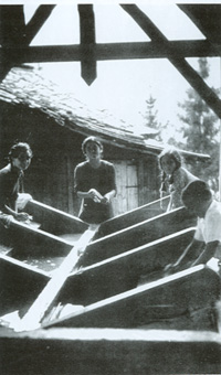
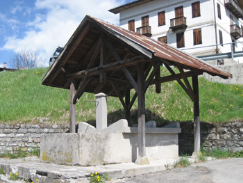
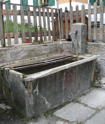
Every neighbourhood in the province once had its own fountain that supplied water, or a tub to wash clothes in, but many of these constructions have not survived. Individual elements of this kind can still be found here and there in the province, but it is only in areas such as Agordo and Auronzo di Cadore that they remain widespread. Most of the washtubs in and around Auronzo were built in cement in the early twentieth century, and often have a wooden roof structure; in most cases, these wooden roofs have been rebuilt in more recent times, as is the case of the tub in the Cella neighbourhood at the entrance to the village, the one in Via Riziò, or the one in Borgata De Filippo. In the Borgata Pais neighbourhood we can see a fountain and washtub composed of eight cement washing basins, at the end of which is a fountain with an external pilaster.
A particularly striking feature of the village of Auronzo is the three-kilometre long artificial lake, created in order to produce electrical energy and popular with tourists, who can enjoy a walk along the Lario lakeside route that sets out from the chalets, or southwards, from the dam opposite the sixteenth-century Church of Santa Caterina, in the Cella neighbourhood. Thanks to the recent archaeological discoveries regarding a sanctuary on Monte Calvario and in other sites in the village centre, we can now be certain that Auronzo (the origin of whose name remains unclear) was frequented as far back as the 2nd century B.C.
From Pieve di Cadore, follow the signs for Sappada/Auronzo and continue straight on along the SR48, avoiding the opening for the Comelico tunnel. Once you reach the village of Auronzo, you can visit the various neighbourhoods, most of which lie upstream from the main roads.
ACCESSIBLE: yes
MUNICIPALITY: Auronzo di Cadore
PLACE: Scattered around the neighbourhoods of Auronzo (Cella, Rizio, De Filippo, Pais)
GEOGRAPHICAL COORDINATES: X 1763467 - Y 5161290
PROVINCE: Belluno
FILE COMPILED BY: Lonzi
Between the nineteenth and twentieth centuries, in Villagrande di Auronzo, along the irrigation channel deriving from the Pondarin brook, a number of activities developed that were connected to the use of water, such as mills, sawmills and dye-works. These included the Pais Golin blacksmith’s forge (71 AI) in Via Ajarnola and the Vecellio del Frate forge in Via Monti. Numerous craft businesses also sprang up on the banks of the Ostera, Diebba and Socosta torrents.
The whole valley is crossed by eleven torrents, which flow into the Ansiei, stemmed by the Santa Caterina dam at Cella, built in 1930. Particularly interesting is the Auronzo Town Hall building (138 AC), which faces onto the lake and was designed in 1975 by Edoardo Gellner, the same architect that in 1955 devised, on the orders of Enrico Mattei, the ENEL village in Corte di Borca di Cadore (137 AC), composed of little villas, a holiday camp, a campsite, hotel and church dedicated to Nostra Signora del Cadore.
M.S. - A. Guzzon, Cadore. Architettura e Arte, Padua, 2008
I. Da Deppo, E. Favero, L’acqua e le sue forme. Lavatoi e fontane, Tipografia Piave, Belluno, 2003
G.P. Becher, Auronzo: terra di frontiera, Auronzo, 1999
