| Card n. | Description | Locality | Linked sites |
| 68 | Wells in Mel | Mel | 77 - 82 - 35 |
| file .pdf | Ethnographic Sites (SE) | Google maps |
 |
 |
- Description
- How to get there
- Interesting facts
- Bibliography
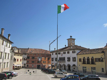
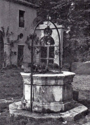
The historic centre of Mel sits on a hill on the left side of the Piave, on the slopes of the Belluno side of the Pre-Alps. The village of Mel is worth a visit not only for its interesting buildings and renowned archaeological site, but also for the numerous communicating wells to be found there. The fifteen or so cisterns in the centre of the village were once part of a single water collection system right on the hill of Mel, where the earth is permeable and there is no ground water that can easily be collected. The wells and the pipes that link them up were made watertight using layers of clay transported there for the purpose. This complex system is believed to have been constructed before the 14th century, and may even date back to Byzantine times, or the Roman Age, i.e. before the village was abandoned as a result of the Barbarian invasions that took place throughout the Val Belluna. The system was maintained over the centuries and restored under the Republic of Venice.
In order to conserve natural ice, meat and butter, for two centuries the people of Mel used the giathera (82 IA), in Via Vittime di Via D'Amelio, which belonged to the Fulcis family in the 18th century. The ice was taken from the secondary streams of the River Piave and the Ardo and Puner torrents and then transported on carts to Mel.
You can reach the centre of Mel along the SP1 from the left side of Piave; take Via Tempietto/Borgo Garibaldi, which goes up to the hill Mel sits on.
ACCESSIBLE: no
MUNICIPALITY: Mel
PLACE: Mel
GEOGRAPHICAL COORDINATES: X 1738215 - Y 5105639
PROVINCE: Belluno
FILE COMPILED BY: Bonato/Vallerani
Not far from the centre of Mel is a characteristic hamlet near the Terchie torrent, which flows into the Piave just downstream from here. During the 15th century, Follo di Mel (35 HAA), which lies just off the busy roads, between the hills and the watercourses, became famous for processing wool, as the place name (follo = fulling) indicates, although no trace of the establishments has survived. The operations required to process the wool were rather complex, and were usually divided up among the families who settled in particularly water-rich areas to carry out such operations. In particular, the fulling process gave its name to a number of places where water was abundant, such as Fol di Belluno along the Ardo torrent, or Follina, along the Soligo in the Treviso area.
Various Authors, Il Veneto paese per paese, Florence, 1998
E. Comiotto, D. Tonet, M. Vedana, Castello di Zumelle. Castrum Zumellarum, Rebellato, S.Donà di Piave, 1992
S. Francescon, N. Sartori, Mel. Storia e leggende, arte e usanze, Belluno, 1991
