| Card n. | Description | Locality | Linked sites |
| 80 | Brentella reclamation consortium reservoir | Alano di Piave | 86 - 194 - 90 |
| file .pdf | Industrial Archaeology (AI) | Google maps |
 |
- Description
- How to get there
- Interesting facts
- Bibliography
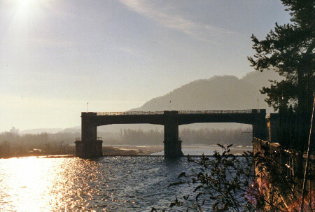
The Brentella Consortium reservoir complex, built in Fener between 1926 and 1929, is the result of a chain of events that came together to solve the precarious situation that had persisted for about five centuries. Until then (excluding a more stable reservoir built at Molinetto in 1919, after the end of the war), the dam was composed of a simply made building for the actual sluice gates and a traverse perpendicular to the Piave, composed of wooden tripods driven into the bed of the torrent, onto which were grafted bundles of branches (sometimes corn or even stems of hemp), which were used to stem the current and channel it into the reservoir. A whole series of elements (the tendency of the Piave to veer towards the left, the interests in the area of the newly set up company that was to establish the Canapificio Veneto hemp spinning plant and the presence of the Treviso-Belluno rail line (194 IA) running through Crocetta, together with the insistence of the SADE company, which also wanted to use the water of the canal for intensive electrical energy production) led to the drafting, in 1926, of a final plan by Guido Dall’Armi that incorporated the previous versions from 1885 and 1912. The reservoir system is composed of a 326 m long, 4 m wide dam with a flattened half-funnel shape, a sluice gate to trap gravel, composed of two 22.5 metre free heights fitted with automatic sector sluice gates and a tank containing the water required for the operation. The delicate system of counterbalances and valves allows for automatic control of the water surface level. There is also a sedimentation and bottom draining basin measuring 35 metres long by 6.5 wide, composed of 7 mouths with a net clearance of 4.25 m each. After this comes the sedimentation basin, with a surface area of about 2000 m2, the purpose of which is to trap the solid material carried along by the river that has somehow managed to get through the sluice gates. The basin is provided with 5 discharge outlets, each 1.9 metres wide. On the western side of the basin is the inlet of the derivation channel.
The dam and reservoir complex is situated along the Piave, and is clearly visible from the bridge that links Fener to Segusino on the SP32. The bridge can be reached from both the SP28 on the left side of the Piave and from the SR348 Feltrina road.
ACCESSIBLE: outside only
MUNICIPALITY: Alano di Piave
PLACE: Fener
GEOGRAPHICAL COORDINATES: X 1727676 - Y 5088176
PROVINCE: Belluno
FILE COMPILED BY: Antoniol
In the western sector of the municipalities of Alano and Quero there are mountain areas given over to cattle rearing, where a number of small dairy farms and pastures can be found, some of which are still used. Next to them you can see the so-called “lame (90 SE)”, wells used for drinking water.
F. Antoniol, Acque antiche… Nuove industrie. L’acqua del canale Brentella e lo sviluppo dell’ energia elettrica, Vicenza, 2009
G. Cenedese, Cenni sull’origine, organizzazione e sviluppo del Consorzio Irriguo Brentella di Pederobba in provincia di Treviso, Vicenza, 2007
A. Serena, G. Dall'Armi, S. Mazzarolo, Il canale della Brentella e le nuove opere di presa e di derivazione nel quinto secolo dagli inizi. Cronistoria, descrizione tecnica, ordinamento, Treviso, 1929
