| Card n. | Description | Locality | Linked sites |
| 89 | Riù Torrent and Via dei Molini (Mills Route) | Segusino | 177 - 196 |
| file .pdf | Ethnographic Sites (SE) - Naturalistic Interest Sites (SIN) | Google maps |
 |
 |
 |
- Description
- How to get there
- Interesting facts
- Bibliography
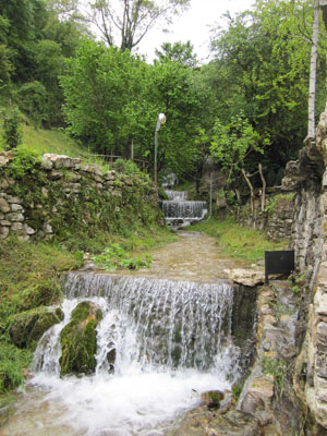
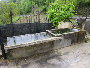
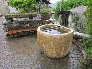
The narrow valley of the Riù torrent, an affluent of the Piave, stretches for about five kilometres north of the village of Segusino, creating a particularly important natural landscape, characterised by the fine quality of the water. Along the path that flanks the Riù, on the left-hand side, were a series of mills that were run using the waters of the torrent. In the val de mulin are the neighbourhoods of Riva Secca and Riva Grassa, which formed during the Middle Ages, featuring characteristic stone dwellings and located on the left and right bank of the torrent respectively. The houses are built close together, almost clinging to the rock buttresses of the Pre-Alps; many of the houses in Riva Grassa feature archways that offer a glimpse of the courtyards that lie inside. Moving on northwards, you will come to the attractive Borgo di Stramare (196 HAA/ES), from where you can admire the whole of the Riù gorge right to the Piave valley. The village, once under the jurisdiction of Milies, is mentioned for the first time between the late 18th and early 19th century, in the Austrian Kriegskarte. What is today a residential area, without any permanent inhabitants, was probably initially populated by workers attracted to the area by the amount of water available and the huge reserves of timber suitable for coal. The name of this neighbourhood probably derives from “Stramare”, the surname of the families who lived there until the seventeenth century, and not the other way round, as more commonly occurs. Next to the nineteenth-century Church of San Valentino is an interesting fountain made from a single block of stone brought from the Trentino area, dating to the 18th century. The Val de mulin is one of the stages on the “Water Routes” itinerary, provided with explanatory panels, which touches on a number of areas in the Comunità Montana of the Treviso Pre-Alps.
From Belluno, take the SP1bis until the Vas roundabout, then go through the tunnel and head towards the village of Segusino.
For those coming from the SP348 Feltrina, at the Fener bridge, take right towards Segusino; alternatively, the SP28 will take you to the road on the left of the Piave; in both cases, go along Viale Italia, and after Piazza del Comune, turn right into Via Riva Grassa / Via Molini. From here the road heads up towards the neighbourhoods of Stramare and Milies.
ACCESSIBLE: yes
MUNICIPALITY: Segusino
PLACE: Riva Secca, Riva Grassa and Stramare
GEOGRAPHICAL COORDINATES: X 1729269 - Y 5089495
PROVINCE: TV
FILE COMPILED BY: Bonato
Not far from the centre of Segusino is the Piave flood plain, featuring a wealth of tall trees and of considerable interest to naturalists.
L. Mariano, Stramare un borgo, un cognome, Feltre, 2008
B. Brizi, Segusino. Per la sua storia, Cornuda, 2007
Various Authors, Il Piave, Verona, 2000
F. De Bin, V. Toniello, Le prealpi trevigiane. Guida alle escursioni, Vittorio Veneto, 1997
