| Card n. | Description | Locality | Linked sites |
| 90 | Abbey of Santa Bona | Vidor | 181 - 165 - 170 |
| file .pdf | Architecture Art History (ASA) | Google maps |
 |
 |
- Description
- How to get there
- Interesting facts
- Bibliography
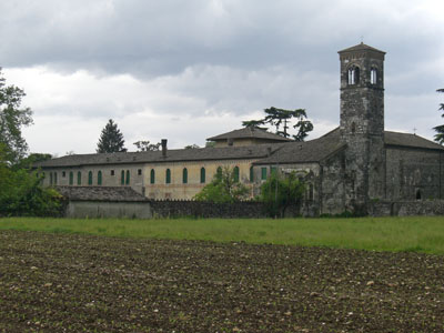
Between Covolo, at Barche, and Vidor, at the hill, there was once a ford on the Piave, which was vital for the local economy, given that there were no bridges. At the port, the Abbey of Santa Bona was built, and we know from the maps of the time that it took control over this important passage route. The abbey complex, comprising the church, a large cloister, a series of other annexes and traces of masonry adjacencies, was originally built in the 12th century and depended on the Abbey of Santa Maria di Formosa, but was almost completely rebuilt following the serious damage it suffered during the First World War that was so fiercely fought on the banks of the Piave. The church, built in the simple, modest style characteristic of Romanesque architecture, once held the relics of the Egyptian saint Bona, brought here by the wealthy Count Giovanni Gravone on his return from the First Crusade. The 12th-century cloister is one of the most interesting parts of the abbey, featuring a series of decorated columns reminiscent of those of Follina, as well as frescoes from various periods, including a thirteenth-century one of San Cristoforo, the patron saint of travellers and ferrymen. Except for particular occasions, access to the abbey is forbidden, as it is private property; it is, however, possible to take a walk around the perimeter of the complex and in the open space that looks onto the bed of the Piave. Spread among the municipalities of Vidor, Farra di Soligo, Moriago and Sernaglia della Battaglia is the Palù Quartier del Piave (165 NS): a marshy area reclaimed by the monks from the abbey of Vidor in the 12th century, creating fields divided up by rows of trees.
From the SP2, after the bridge over the Piave, take Via Ponte Vecchio along the SP34, then Via Monte Grappa, driving through the centre of Vidor; after Piazza Zadra, take right at the fork into Via Piave and follow the tourist signs for the abbey, which sits right on the banks of the Piave.
ACCESSIBLE: yes
MUNICIPALITY: Vidor
PLACE: Abbey (Santa Bona)
GEOGRAPHICAL COORDINATES: X 1735921 – Y 5082644
PROVINCE: TV
FILE COMPILED BY: Visentin/Rossi/Vallerani
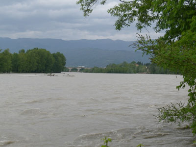
On the left side of the Piave, at Bigolino, is a riverside park equipped with recreational facilities, known as “Parco del Piave” (170 NS). You can reach the park from the square in Bigolino and from the banks of San Pellegrino, behind the capital of the same name. The capital is an excellent point from which to admire the hills of Asolo, the villages of Pederobba and Onigo on the other side of the river, and further north, the narrow of Quero and the nearby morainic reliefs.
G. Mazzotti, Treviso. Piave-Grappa-Montello, Vittorio Veneto, 2007
C. Rubini, E. Cipriani, escursioni nell’alto trevigiano. 32 itinerari, Verona, 1994
D. Gasparini, Due villaggi della collina trevigiana Vidor e Colbertaldo, Cornuda, 1989
E. Spagnolo, Abbazia S. Bona di Vidor, Cittadella, 1980
